Read Executive Summary
Read Report: Figure 20 Predicted Sediment Textures
Read Report: Figure 25 Predicted Habitats
Addendum: Benthic Invertebrate Study
Executive Summary
Deschutes River Estuary Restoration Feasibility Study
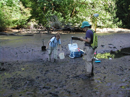
The goal to this study is to evaluate the feasibility of restoring the Deschutes River Estuary (Capitol Lake) as an alternative to managing a lake. Earth Design Consultants, Inc. is sampling biological and physical variables from multiple estuarine community types of several reference estuaries. The environmental variables include: elevation, sediment grain size/characteristics, and salinity.
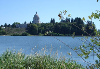
In 1951, a dam was constructed across the southern portion of Budd Inlet (Olympia, WA) creating freshwater lake in what was once a tidal wetland. Since the dam was constructed, Capitol Lake has been plagued with water quality and sedimentation issues. Consequently, the Capitol Lake Adaptive Management Plan (CLAMP) Steering Committee initiated a project to study the feasibility of restoring the estuary.
What is remarkable about this project is that it involves evaluation of several restoration alternatives using a high-tech modeling tool. Costs and benefits of the various restoration alternatives, as well as a “do nothing” alternative, will be evaluated and restoration performance goals will be set before any on-the-ground restoration action is taken. The tool being
used is a sophisticated model developed by U.S. Geological Survey (Menlo Park, CA) which predicts sediment transport, water velocity, and salinity patterns in the estuary to be restored. The modeling tool uses river gage, tidal, wind, bathymetry, sediment, and salinity data as input variables.
Using the estuary’s, underwater topography (morphometry), or shape of the estuary basin, the computer model describes patterns of sediment transport, salinity, water velocity, and inundation patterns modeled under different river flow and restoration scenarios. The model predicts where sand and mud flats will likely occur and expected erosional patterns associated with channels and different flow regimes.
Approach
We used multivariate statistics to develop empirical relationships between estuarine plant community types and the environmental variables. We then used these relationships to predict the likely outcome of restoration scenarios in the Deschutes River Estuary using the USGS Delft3/ SWAN models.
Rather than using indicators or single variable approaches to evaluate restoration success, we used the relationships between communities and measured environmental gradients developed during this project to track likely restoration trajectory paths through multidimensional state space.
Earth Design Consultants, Inc. field crews visited nearby estuaries to sample plant and animal communities and measure key environmental
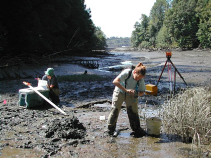
variables at these reference estuaries. The field data were used to develop statistical relationships describing the association of plant and animal communities with the environmental factors which organize those communities. These statistical relationships were then used in the model to predict what communities were likely to occur under each of the potential restoration scenarios. This information will be used by managers to evaluate each of the scenarios. In this suite of studies, field data and computer modeling will be used to evaluate alternative restoration plans for the removal of a dam before removing one brick. Models are useful tools for examining the influence of site-specific and landscape variables on restoration projects.