REPORT LINK
October 2003
Executive Summary
Using Landsat 7 ETM+ Imagery to Map Estuarine Habitats: a Broad Brush
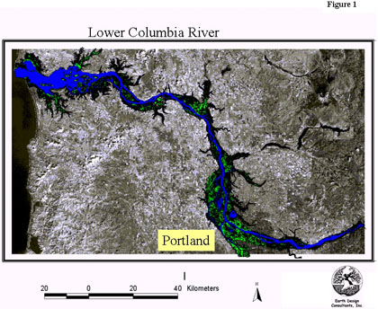
Developing an understanding of the distribution and changes in estuarine and riparian habitat cover is critical to the management of biological resources in the lower Columbia River. The Lower Columbia River Estuary Partnership (Estuary Partnership) completed a comprehensive ecosystem protection and enhancement plan for the lower Columbia River and estuary in 1999 (Jerrick, 1999). The plan identified habitat loss and modification as one of the key threats to the integrity of the lower Columbia River ecosystem and called for an inventory of habitat as a key first step in its long-term restoration effort. In 2000, the Estuary Partnership initiated this project to produce a spatial data set describing the current location and distribution of habitat cover types along the lower Columbia River from the river mouth to the Bonneville Dam (~230 River km).
Results from this study will be used by the Estuary Partnership and its cooperators to:
This study focused on estuarine and riparian floodplain habitat cover types, which are important to native species, particularly juvenile salmonids. Results from this study are meant to provide support for the multiple efforts currently underway to recover 12 species of Columbia River salmonids identified as endangered or threatened under the Endangered Species Act.
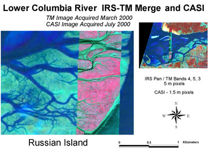
The ability to resolve estuarine habitat features depends on the spatial and spectral resolution of these types imagery. We acquired and are classifying several types of remotely sensed imagery for this project including: Landsat 7 ETM+ multispectral and panchromatic imagery, IRS panchromatic imagery , and CASI hyperspectral imagery


This information will be used in conjunction with several other ongoing projects: ODFW’s Juvenile salmonid life history reconstruction project, Wetland Mapping by DSL, Landscape Scale Habitat Change Analysis, and a Functional Assessment of Salmonid Habitat.
Project Description
We classified estuarine and riparian floodplain habitats along ~230 km of the lower Columbia River, encompassing an area of 193,000 ha. While we did classify some of the upland areas in the Chinook watershed, most of the upland areas along the lower Columbia River were excluded by a DEM (elevation) mask. As we expected, the largest habitat class was the deep-water habitat, which covered 30.9% of the classified area. We found that much of the study area was vegetated: herbaceous and woody (shrub-scrub and forested)
vegetation accounted for 29.9% and 23.2% of the classified area, respectively. Urban areas accounted for ~11.0% of the area classified. Vegetated wetland areas (herbaceous, shrub-scrub and forested) accounted for a relatively small proportion (8.4%) of the study area and unvegetated areas (mud and sand flats) subject to tidal inundation accounted for an additional 4.4% of the study area. Vegetated uplands accounted for 44.7% of the area classified.
