REPORT LINK (450 KB)
REPORT LINK-APPENDIX I (41 MB)
August 1999
Executive Summary
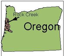
Earth Design Consultants, Inc., Green Point Consulting, and Oregon State University Graduate student, Anu Gupta worked together with the Siletz Watershed Group (SWG) to complete a Watershed Assessment for the Rock Creek watershed in the Siletz River basin. This fifth-field watershed is located at the intersection of Polk, Benton and Lincoln Counties in the Coast Range of Oregon.
The primary goals of this assessment were to inventory and characterize watershed components and to evaluate watershed processes that influence abundance and distribution of salmonids and other valued wildlife. Products from this work include: a series of monitoring and management action recommendations; summary and base map geographical information system data layers; and identification of important data gaps and recommendations for filling those gaps.
In this assessment, we want to emphasize that watershed processes themselves, such as landslides and sediment transport, cannot be characterized as either good or bad. Instead, we need to address the likely impact of these processes on valued resources within the watershed through detailed study. For example, landslides are a natural component of Pacific Northwest watersheds. The same landslides and debris flows
that choke streams with fine sediments and silts are also an important source of gravel necessary for salmon spawning. Landslides may be a concern wherever human actions have altered their frequency, magnitude, and position in the watershed.
In this assessment we address important issues within the Rock Creek watershed that were identified by the Siletz Watershed Group in 1997 (SWG 1997). These issues include water quality and quantity; aquatic and fish habitat; slides and erosion control; and land use. All of these issues are key to this assessment, and are also components of the 1997 GWEB Draft Watershed Assessment Manual (Non-Point Source Solutions 1997).
Approach
In conducting this assessment, we used methods that had the following characteristics:
Report Photos
The report and figures are in PDF format and range in size from 100 to 1,600K. You will need the Adobe Acrobat Reader to view the files. The Acrobat Reader is free and can be downloaded from www.adobe.com. A hard copy of this report is available from the MidCoast Watersheds Council.
Figure 3.16 (paper map)